


Single - London Freight Map (Laminated)
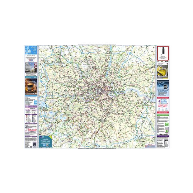
The London Freight Map for transport managers and haulage companies who operate in London. This is a laminated wall map. Enables compliant route planning to the London Councils London Lorry Control Scheme (Lorry Ban). The detailed map includes: Borough Boundaries New London Lorry Control Scheme Boundaries London-wide weekend and night...
£29.00
The London Freight Map for transport managers and haulage companies who operate in London. This is a laminated wall map. Enables compliant route planning to the London Councils London Lorry Control Scheme (Lorry Ban).
The detailed map includes:
- Borough Boundaries
- New London Lorry Control Scheme Boundaries
- London-wide weekend and night time restrictions
- All excluded (unrestricted) roads clearly marked
- Navigation aids that include:
- Tube and rail stations.
- Industrial estates
- Parks and key landmarks
- All the height, weight and width restrictions clearly marked.
- Bridge strike (top 10)
- LEZ (Low Emission Zone)
The 'Wall Map' measures 137cm by 98cm
Supplied rolled


